INTERPRETATION
DISCUSSION
|
Regional and Mesoscale Meteorology Team Cooperative Institute for Research in the Atmosphere (CIRA) Colorado State University Fort Collins, Colorado |

October 10, 2001
|
October 9, 2001 Great Plains Tornado Event |
On 9 October 2001, the Storm Prediction Center (SPC) issued a Moderate risk for portions of the central and southern Plains. Super Rapid Scan Operations (SRSO) were activated by CIRA forecasters. This schedule on GOES-12 delivers continuous 1 minute interval imagery. The outlook was based on several factors including an approaching upper low moving towards the Plains.
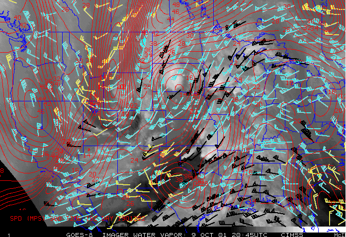
The GOES-derived winds overlaid on water vapor imagery (Figure 1) shows a jet streak over west central Texas and associated strong upper flow over Oklahoma. For the key and more information on this product click here. The stronger flow extends northeastward into eastern Nebraska. However, there was a wind minimum over western and central Nebraska drifting slowly eastward. A serious forecast problem for this region involved where the storms would form relative to the upper jet. If the storms over Kansas and Nebraska formed further east beneath the stronger winds they would have a better chance of becoming severe due to deep-layer shear. At the surface, a low was located in extreme southwest Nebraska. A dryline stretched southward from the low into west Texas. CAPE values between 3000 and 4000 J/kg were realized in Oklahoma and Nebraska as observed on the NESDIS single-field-of-view GOES derived product imagery (Figure 2).

Storms formed along the dryline and quickly became severe in Oklahoma. Figure 3 shows GOES-12 visible imagery for the period 20:46 - 21:23 UTC. The yellow "+" shows the location of Cordell, OK. Notice that Cordell is situated along an east-west oriented outflow boundary. This coincidence is important as the convection develops.
Figure 4 shows the GOES-12 visible imagery from 21:40 - 22:10 UTC. A large tornado (F4 by preliminary estimates) was reported in Cordell at 22:08 UTC. The storm that affected Cordell appears to have initiated southwest of the city and intensified when it interacted with the east-west oriented boundary. It appears from visible imagery that this cell traveled along the boundary for some time. Taking parallax into consideration, the location of the overshooting tops implies that the updraft probably was on or near the boundary during the time when the tornado was affecting the region in and around Cordell. This behavior is similar to storms documented by Markowski et al. (Weather and Forecasting 1998) during VORTEX-95.
Figure 5 shows the GOES-12 visible imagery from 21:15 - 22:02 UTC centered over Kansas and Nebraska. The imagery shows storms developing along the dryline. The northernmost cell is situated on an east-west boundary separating a region of wave clouds (in northeastern Nebraska) from an area of cumulus cloud streets to the south. As the storm moves east the cloud streets can be seen feeding into the southeastern flank of this storm.
Figure 6 shows the GOES-12 visible imagery
from 22:04 - 22:52 UTC. A series of tornadoes (from the SPC preliminary
storm reports) is reported beginning at 22:08 UTC.

Figure 1 |
Click on images to start loops or enlarge images |

Figure 2 |

Figure 3 |

Figure 4 |

Figure 5 |

Figure 6 |