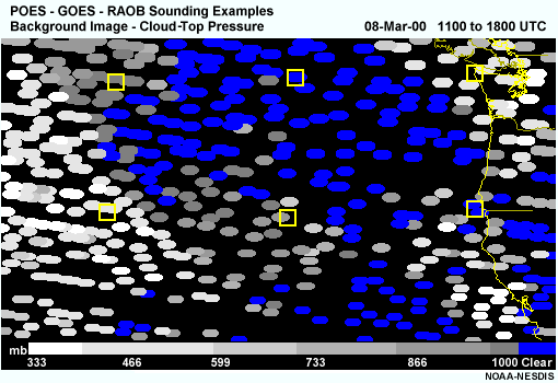
Each gray shaded (cloudy) or blue (clear) dot defines a POES sounding location. GOES soundings for each box were selected within about 50 km of the POES sounding location and represent the same cloud/no cloud conditions.
Weather conditions and geographic location affect the distribution of POES, GOES, and RAOB sounding data. The example shown here suggests that integration of all three data sources can lead to improved synoptic analyses.
The image shows early morning sounding coverage for a single POES satellite (NOAA-15) along coastal regions of the Pacific Northwest. Two orbital swaths cover the region. Data coverage for the right one-third of the image occurs at about 15:50 UTC and for remaining points west at about 17:30 UTC.