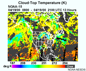
Cloud-top temperature shows cloud-top temperatures in Kelvins. Average resolution is 40 km in the horizontal (at nadir) and 50 mb in the vertical. The cloud-top temperature is determined for cloudy High-Resolution Infrared Radiation Sounder (HIRS) fields-of-view (FOVs) using a CO2 slicing method similar to the one applied to GOES sounder data (SATMET-3: Using the GOES Sounder; Menzel et al. 1983).